Elites will roll from St. Elmo Foods City at 8:30 as well, but head south towards the cove (but not all the way). Take Captain Wood Rd over to Hog Jowl and then back via Kensington, Boss Rd, Marble Top, and of course the Fish Hook at the end in Flintstone. See map for details. 55 miles.
Sat. 5/21 On Vacation
Bubba’s on vacation at Fall Creek Falls. For those that couldn’t make the trip I suggest someone hijack Boss’s email list and post a ride. Have fun.
TB 6/18 – Bub One! Invitational (B1I)
TB rolls from the Bub One! Chicken Ranch (Burnt Mill Road) at 8:30 for the Bub One! Invitational. 65 miles and 3800’ with several opportunities to shortcut along the way.
Stick around post-ride to eat some big ole pork butts smoked by Slick and Cowboy! Remember this is a fundraiser to help Bub One! since he is out of work because of the crash so eat/donate/drink/and donate some more!
Check back for the final map coming soon.
Sat. 4/30
Elites will roll from Soddy Ball Fields at 8:30 and have 2 options. The first is to latch on to TB when they whiz by and chase them until you puke. Option 2 is to ride up Leggett and then back down Brayton Mtn. Road into Graysville, back via Old McDonald’s farm (soon to be an industrial park), cross 27 at Daugherty Ferry. Poole Rd, May Rd, etc. back to the ball fields. About 47 miles and 3,200 feet.
TB Sat 6/11
Alright Bubbas,
Saturday Team Bubba ride will be a version of the 3 state, that we haven’t done in a while. I don’t have the file on Ride with GPS, but here’s the file from Strava. A metric and about 4.5k vert.
https://www.strava.com/routes/2747159910501899944
Maybe the man in black can find it in his ride with gps archives. Anyway, roll at 8:30am from food city in st elmo
Sat 4/23 Elites
The King will lead the Elites on the same route as TB but with a 8:00 roll out. See map on TB post. First one to Merv’s buys. (Boss made that rule only because he’ll be last.)
Sat. 4/30
Elites will roll from Soddy Ball Fields at 8:30 and have 2 options. The first is to latch on to TB when they whiz by and chase them until you puke. Option 2 is to ride up Leggett and then back down Brayton Mtn. Road into Graysville, back via Old McDonald’s farm (soon to be an industrial park), cross 27 at Daugherty Ferry. Poole Rd, May Rd, etc. back to the ball fields. About 47 miles and 3,200 feet.
TB Sat 4/23
Non-tapering Bubbas will get a chance to get on top with the warm weather as we ride Signal and Mowbry via an old favorite: Henson Gap. Roll at 8:30 from the old Pizza Hut across from Merv’s (Old Kmart/Aldi center – oil folks whined about us parking in the center itself). SPIN up the W (we’ll divide into groups of 2 or 3 so as not to make motorists angry), Marshall Creek gorge, off the back of Signal (ouch), up Henson, across Mowbry by the 10 longest miles (double ouch), down Montlake, and back. Simmer down fellers, this is a hard route and you’ll have plenty of chances to show Saturday ain’t for cornbread eatin once we get up Henson. (Please remember that TB rides are intended to be hard GROUP rides, not races.) A metric and 5000 feet but it’ll seem like much more.
Sat. 4/16
Update! Rollout at 11am
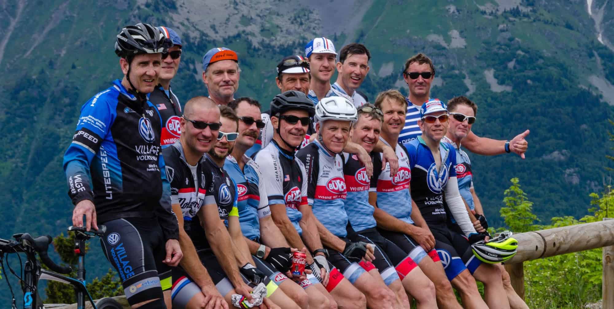
Bub One taking the reins today for both TB and Elites. Weather permitting roll from the St. Elmo Food City at 8:30 for a roll down to the Cove and back. Optional climb up Dougherty Gap (yes closed to car traffic but very doable on a bike). For those not wanting to climb just hang out at the store. On the way back experience the brand new pavement on W. Cove Rd. Group photo at Mural Wall on Oakland Ave. (mile 68.7). Some of us might short route at mile 24.8 Captain Woods Rd.
Rain is now threatening in the morning so stay tuned for a delayed start time.
Sat. 4/2 (River Road Special)
Well, King and Rudy have a got a special one up their sleeve. Going to do a gravel/road ride from the Oosterneck Overlook outside of Tellico for an out and back ride to Murphy (almost). Gravel bike would probably work best but is doable on a road bike. Roll from the Overlook at 10am (see map). Plan on 5+ hours and bring plenty of water. I’m out so any questions should be directed at King and Rudy. Also I’m a little sketchy at exactly when they’ll turnaround so total miles might be a little less than the 68 the map advertises.